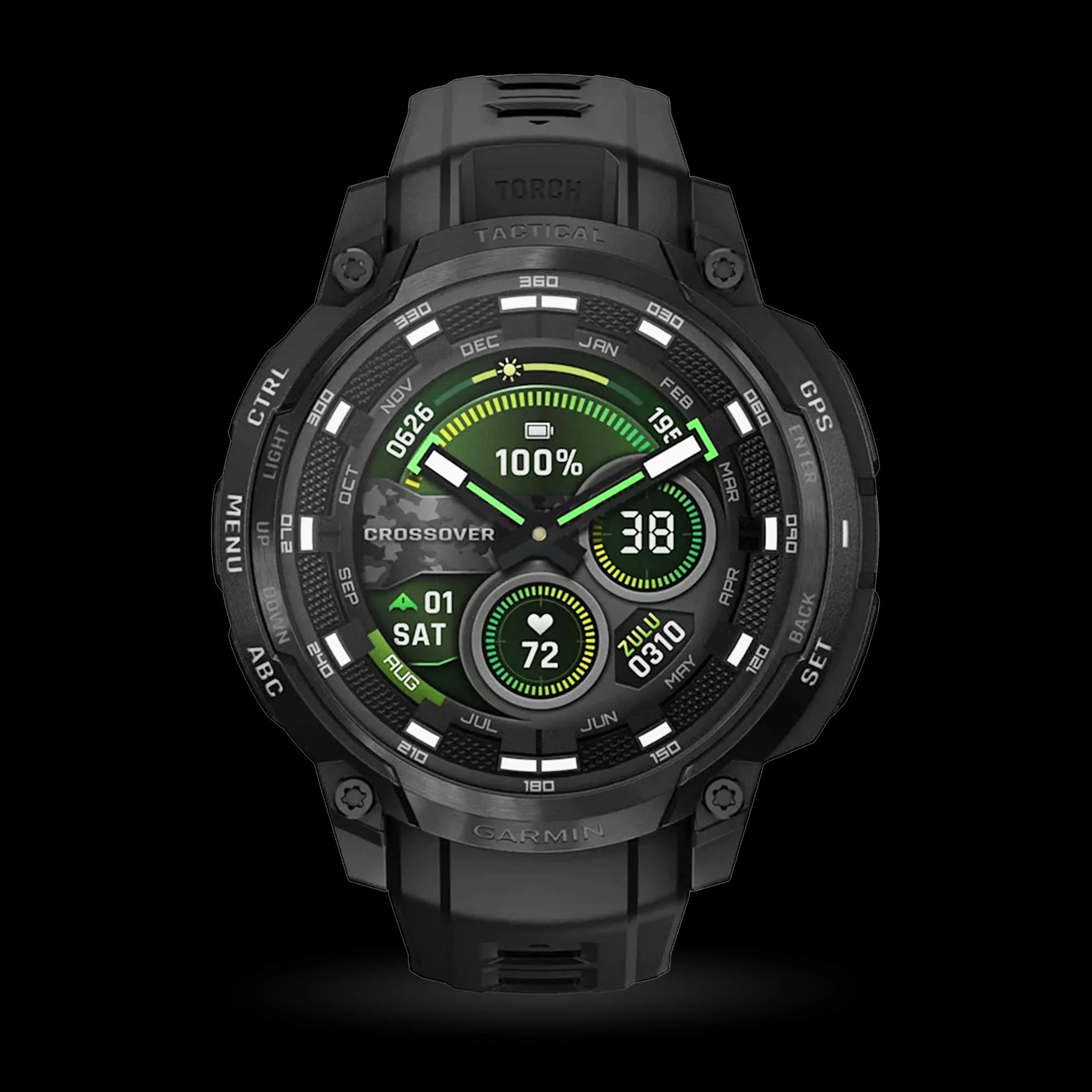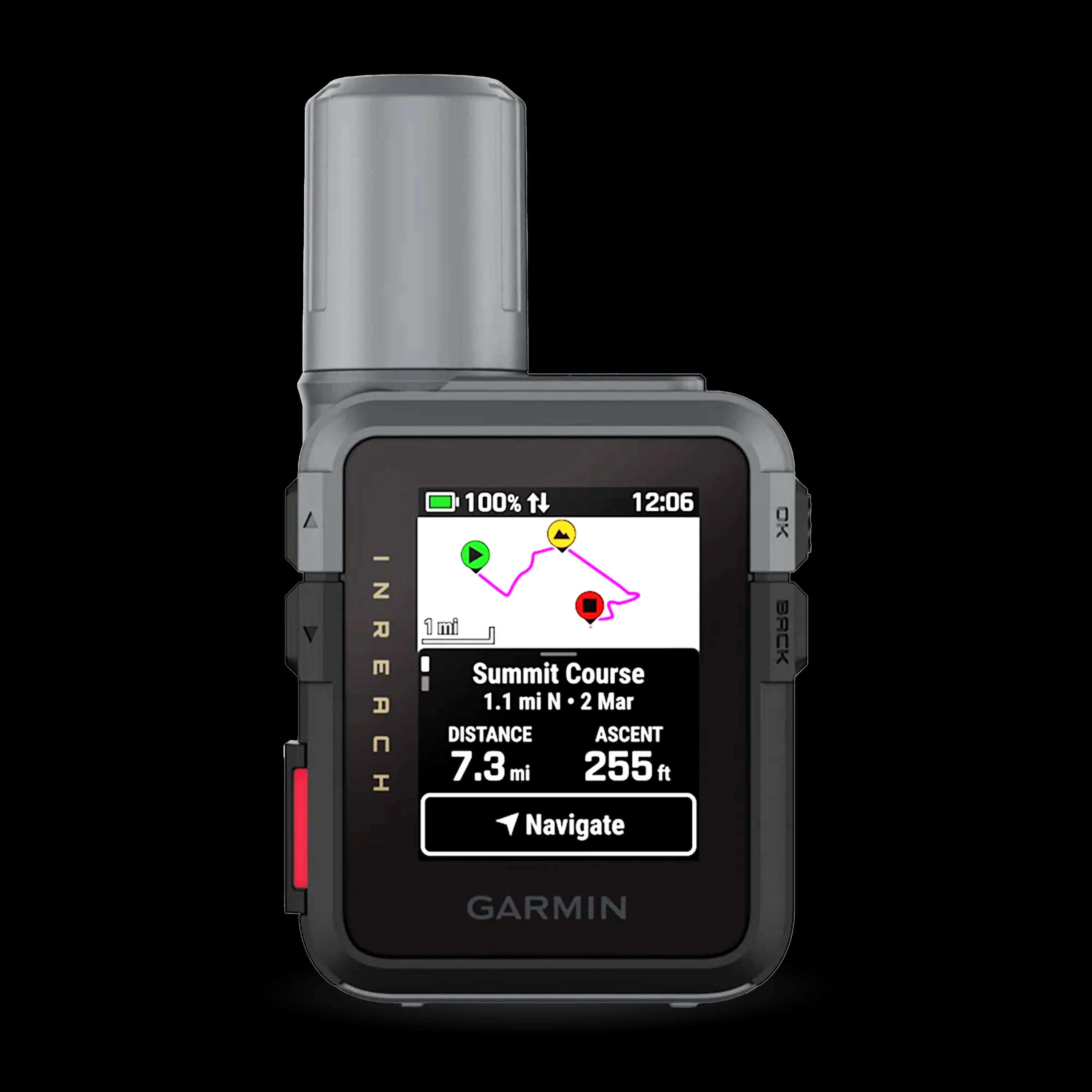
Garmin - GPSMAP® H1i Plus
WHEN ADVENTURE CALLS, RESPOND
This rugged GPS handheld navigator has a modern design, preloaded maps and built-in inReach® Plus technology1 to stay in touch beyond cellular coverage. It’s time to hit the trails.
Features:
-
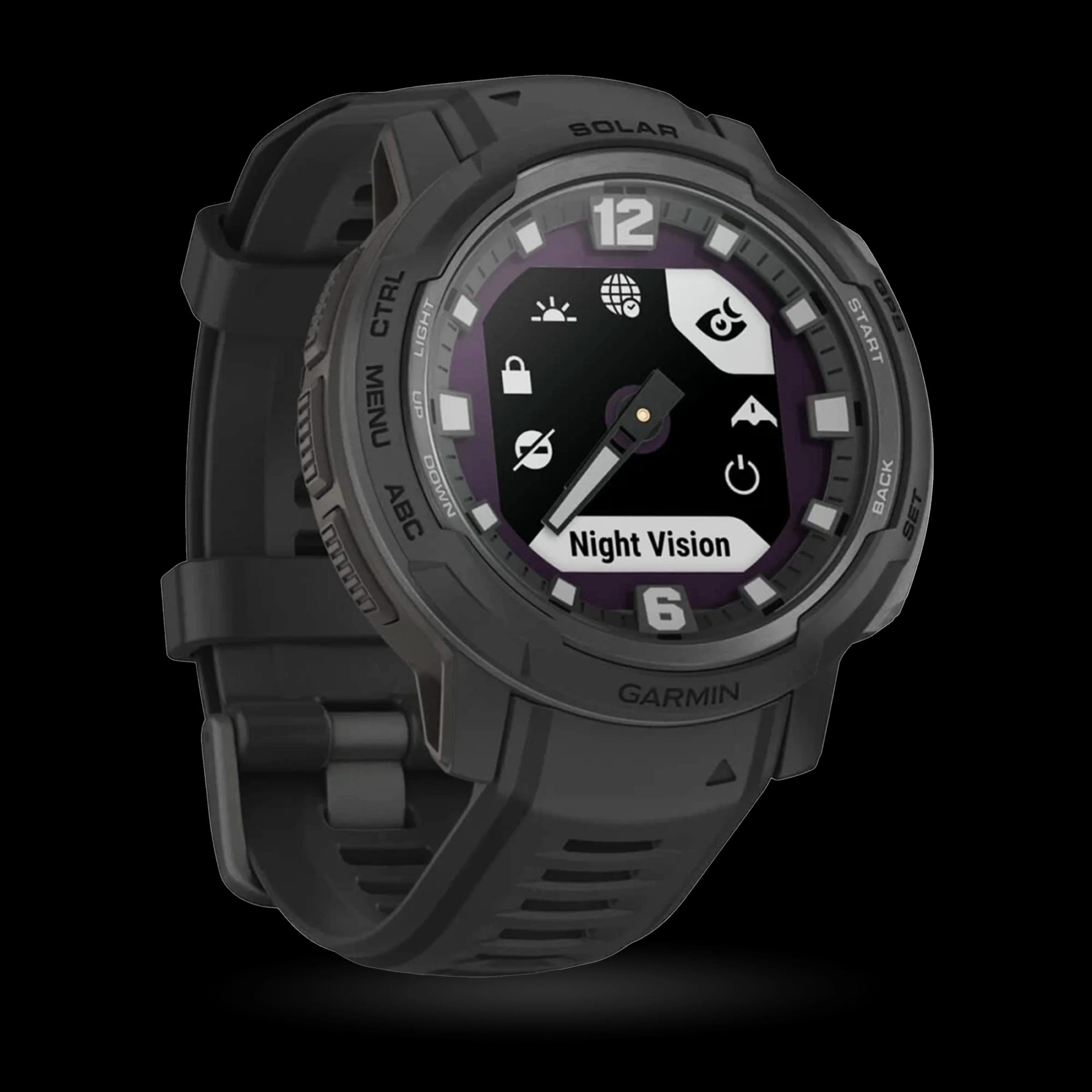
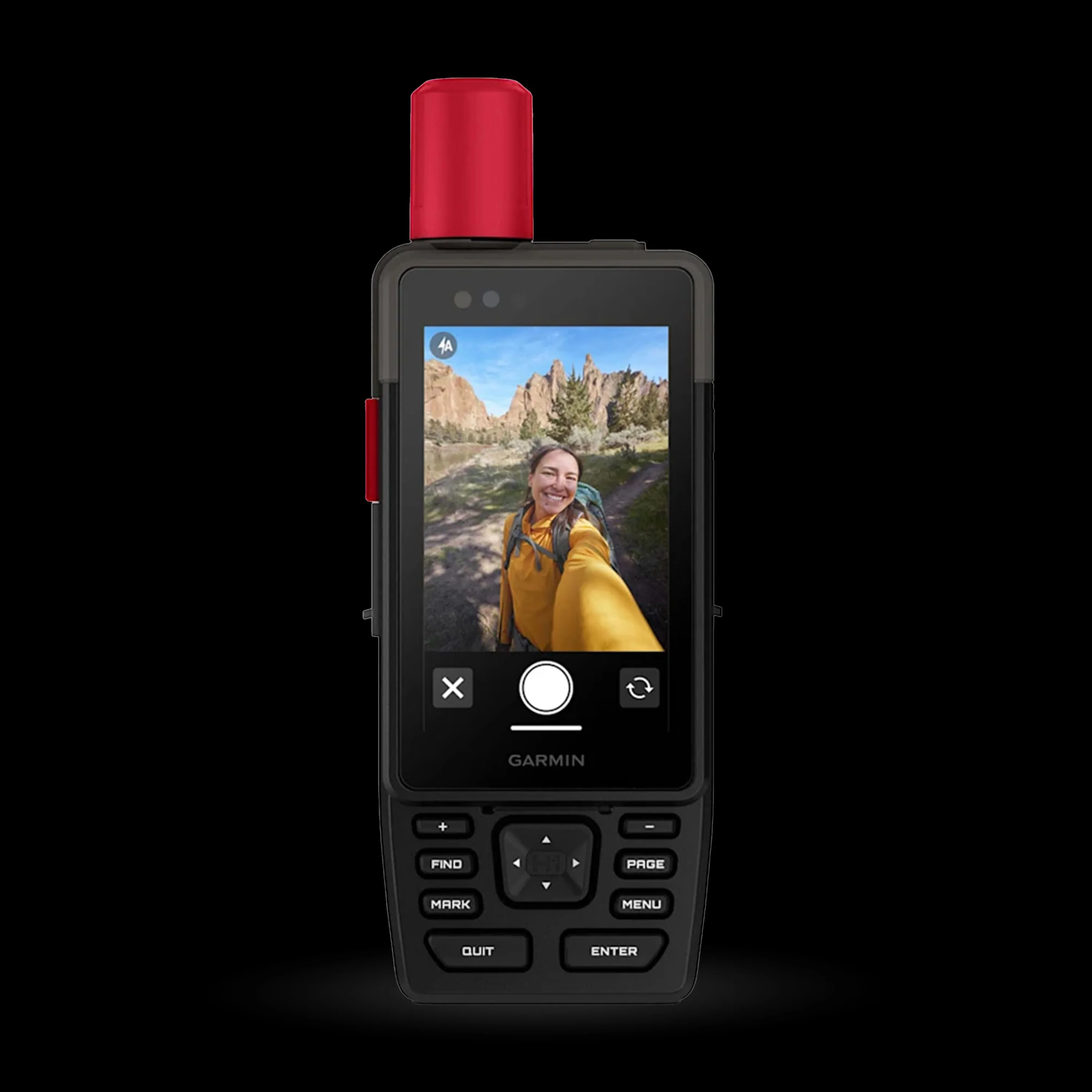
TOUCHSCREEN: The bright, sunlight-readable 3.5-inch color touchscreen has chemically strengthened glass to resist scratches. It is glove-friendly, easy to see and easy to use. Tap, zoom and swipe on the maps to follow your route.
-
PHYSICAL BUTTONS: The rugged hybrid design also features intuitive push buttons for more versatility when operating in weather and while wearing gloves. The quick-action button lets users customize functions to their specific needs.
-
PHOTOS AND VOICE/TEXT MESSAGING: With an active inReach subscription1, send group text messages up to 1,600 characters. You can also exchange photos and voice messages when outside of cellular coverage.
-
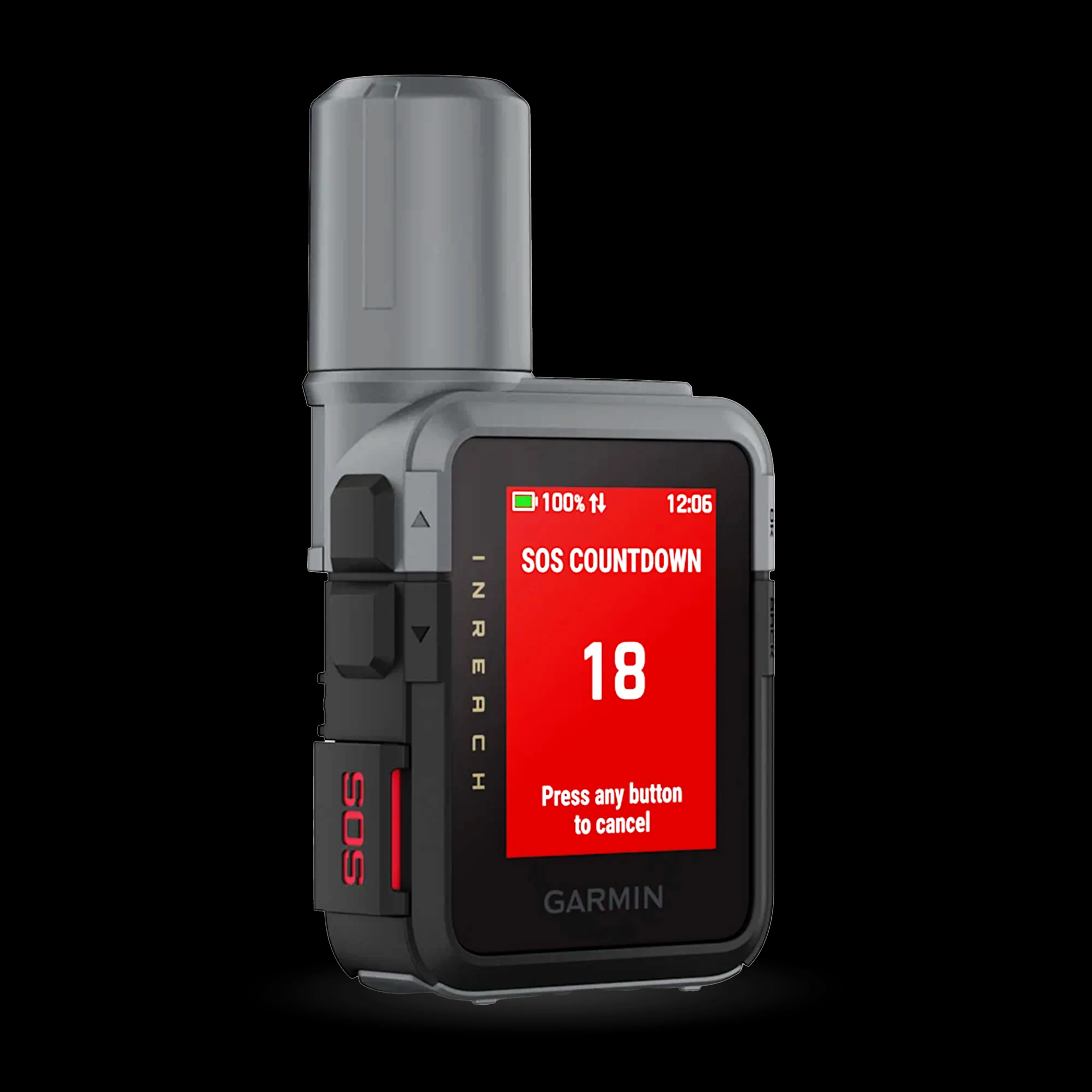
SOS ALERTS: Trigger an interactive SOS message anytime to the 24/7-staffed Garmin Response international coordination center for help in an emergency. This requires an active inReach subscription1.
-
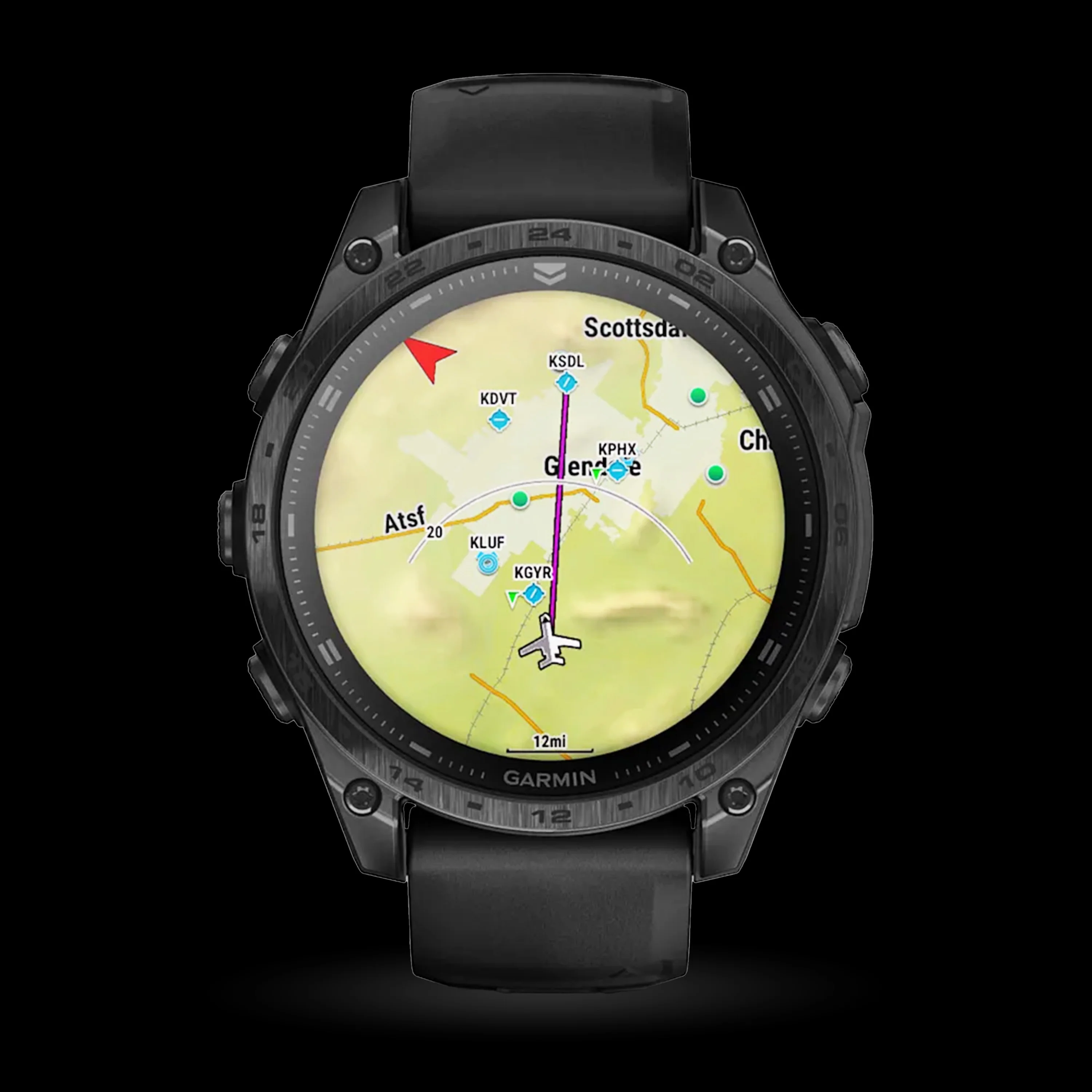
ADVANCED NAVIGATION: Navigate with preloaded TopoActive maps for the U.S., Mexico and Canada — and easy-to-access global maps. See terrain contours, elevations, geographical points and more.
-
OUTDOOR MAPS+: Purchase a subscription to Outdoor Maps+ for ongoing access to a wide variety of premium mapping content, including satellite imagery, campgrounds and more. Download and receive automatic updates via Wi-Fi® technology.
-
SATELLITE IMAGERY: Download high-resolution photorealistic maps directly to your device via Wi-Fi® technology. Find trails, pick stand locations and parking, create waypoints and more.
Specs:
- Dimensions - 2.6" x 7.0" x 1.3" (6.7 cm x 17.9 cm x 3.3cm)
- Display - 3.5" Diagonal - transflective Color TFT
- Water Rating - IP67 & MIL-STD-810
- Connectivity - Wi-Fi®, BLE, ANT+®
- Memory - 64 GB (user space varies based on included mapping)
- Weight - 290g (10.2oz)
Battery Life:
-
All Satellite Systems + Multi-band: Up to 145 hours*
-
Expedition mode: Up to 840 hours
-
Performance messaging mode with 10-min inReach® tracking: Up to 48 hours*
-
Expedition mode with 10-min inReach® tracking: Up to 425 hours
- Low-power mode with 10-min inReach® tracking: Up to 135 hours
- Rechargeable, internal lithium-ion
*Assuming typical use with SatIQ technology
What’s included:
- One Garmin - GPSMAP® H1i Plus
- One Charging/data cable
- One Loop Carabiner
- Documentation
WHEN ADVENTURE CALLS, RESPOND
This rugged GPS handheld navigator has a modern design, preloaded maps and built-in inReach® Plus technology1 to stay in touch beyond cellular coverage. It’s time to hit the trails.
Features:
-
TOUCHSCREEN: The bright, sunlight-readable 3.5-inch color touchscreen has chemically strengthened glass to resist scratches. It is glove-friendly, easy to see and easy to use. Tap, zoom and swipe on the maps to follow your route.
-
PHYSICAL BUTTONS: The rugged hybrid design also features intuitive push buttons for more versatility when operating in weather and while wearing gloves. The quick-action button lets users customize functions to their specific needs.
-
PHOTOS AND VOICE/TEXT MESSAGING: With an active inReach subscription1, send group text messages up to 1,600 characters. You can also exchange photos and voice messages when outside of cellular coverage.
-
SOS ALERTS: Trigger an interactive SOS message anytime to the 24/7-staffed Garmin Response international coordination center for help in an emergency. This requires an active inReach subscription1.
-
ADVANCED NAVIGATION: Navigate with preloaded TopoActive maps for the U.S., Mexico and Canada — and easy-to-access global maps. See terrain contours, elevations, geographical points and more.
-
OUTDOOR MAPS+: Purchase a subscription to Outdoor Maps+ for ongoing access to a wide variety of premium mapping content, including satellite imagery, campgrounds and more. Download and receive automatic updates via Wi-Fi® technology.
-
SATELLITE IMAGERY: Download high-resolution photorealistic maps directly to your device via Wi-Fi® technology. Find trails, pick stand locations and parking, create waypoints and more.
Specs:
- Dimensions - 2.6" x 7.0" x 1.3" (6.7 cm x 17.9 cm x 3.3cm)
- Display - 3.5" Diagonal - transflective Color TFT
- Water Rating - IP67 & MIL-STD-810
- Connectivity - Wi-Fi®, BLE, ANT+®
- Memory - 64 GB (user space varies based on included mapping)
- Weight - 290g (10.2oz)
Battery Life:
-
All Satellite Systems + Multi-band: Up to 145 hours*
-
Expedition mode: Up to 840 hours
-
Performance messaging mode with 10-min inReach® tracking: Up to 48 hours*
-
Expedition mode with 10-min inReach® tracking: Up to 425 hours
- Low-power mode with 10-min inReach® tracking: Up to 135 hours
- Rechargeable, internal lithium-ion
*Assuming typical use with SatIQ technology
What’s included:
- One Garmin - GPSMAP® H1i Plus
- One Charging/data cable
- One Loop Carabiner
- Documentation
Original: $1,058.45
-70%$1,058.45
$317.54Description
WHEN ADVENTURE CALLS, RESPOND
This rugged GPS handheld navigator has a modern design, preloaded maps and built-in inReach® Plus technology1 to stay in touch beyond cellular coverage. It’s time to hit the trails.
Features:
-
TOUCHSCREEN: The bright, sunlight-readable 3.5-inch color touchscreen has chemically strengthened glass to resist scratches. It is glove-friendly, easy to see and easy to use. Tap, zoom and swipe on the maps to follow your route.
-
PHYSICAL BUTTONS: The rugged hybrid design also features intuitive push buttons for more versatility when operating in weather and while wearing gloves. The quick-action button lets users customize functions to their specific needs.
-
PHOTOS AND VOICE/TEXT MESSAGING: With an active inReach subscription1, send group text messages up to 1,600 characters. You can also exchange photos and voice messages when outside of cellular coverage.
-
SOS ALERTS: Trigger an interactive SOS message anytime to the 24/7-staffed Garmin Response international coordination center for help in an emergency. This requires an active inReach subscription1.
-
ADVANCED NAVIGATION: Navigate with preloaded TopoActive maps for the U.S., Mexico and Canada — and easy-to-access global maps. See terrain contours, elevations, geographical points and more.
-
OUTDOOR MAPS+: Purchase a subscription to Outdoor Maps+ for ongoing access to a wide variety of premium mapping content, including satellite imagery, campgrounds and more. Download and receive automatic updates via Wi-Fi® technology.
-
SATELLITE IMAGERY: Download high-resolution photorealistic maps directly to your device via Wi-Fi® technology. Find trails, pick stand locations and parking, create waypoints and more.
Specs:
- Dimensions - 2.6" x 7.0" x 1.3" (6.7 cm x 17.9 cm x 3.3cm)
- Display - 3.5" Diagonal - transflective Color TFT
- Water Rating - IP67 & MIL-STD-810
- Connectivity - Wi-Fi®, BLE, ANT+®
- Memory - 64 GB (user space varies based on included mapping)
- Weight - 290g (10.2oz)
Battery Life:
-
All Satellite Systems + Multi-band: Up to 145 hours*
-
Expedition mode: Up to 840 hours
-
Performance messaging mode with 10-min inReach® tracking: Up to 48 hours*
-
Expedition mode with 10-min inReach® tracking: Up to 425 hours
- Low-power mode with 10-min inReach® tracking: Up to 135 hours
- Rechargeable, internal lithium-ion
*Assuming typical use with SatIQ technology
What’s included:
- One Garmin - GPSMAP® H1i Plus
- One Charging/data cable
- One Loop Carabiner
- Documentation